Like a ship’s captain scanning the horizon before leaving port, you’ll want to layer surf and marine forecasts before a shark dive, because one pretty chart can hide a rough surprise. Start with the marine forecast for wind and swell period, cross check a nearby buoy, then match swell direction to your site’s shelter, and add tide timing so you’re not fighting a conveyor belt at the surface. Next, you’ll learn the quick tells that turn “maybe” into “go.”
Key Takeaways
- Start with NOAA/Coast Guard marine forecasts for swell height, period, direction, wind, and advisories affecting shark-dive cancellations.
- Cross-check buoy data (updated within 8 hours) and surf models/cams to confirm real swell energy and direction near the site.
- Use height plus period together: abort above ~5 ft, especially with long-period 12–18 s swells that drive strong surge.
- Check Windy/Windfinder for nearshore winds, since wind chop and current shifts can make pickups and ladder exits hazardous.
- On-site, watch the ocean 10–20 minutes for sets, breaking zones, and safe entry/exit timing; set an alternate site and abort trigger.
Shark-Dive Go/No-Go Checklist
Before you zip up your wetsuit and start scanning the blue for fins, run a quick go, no-go checklist that treats the ocean like a moving forecast, not a postcard.
First, confirm swell height and period; if it’s over about five feet, or a long 10-plus-second pulse is detonating on the reef, you’ll fight the entry and exit. At NDBC Station 51201 off Waimea Bay, a 14.3-second swell with waves over 10 feet signals powerful, swell-dominant energy that can make even routine surface work and exits hazardous.
Check the tide window and direction, and skip a hard outgoing push that can punch rip lines through channels.
Scan the wind setup; calm or light offshore keeps the surface tidy and your boat work simple.
Finally, factor in local flow and water movement: if you see fast drift, foam streaks, or strong currents, add air for a longer swim, then watch conditions for ten minutes.
Choose Shark-Dive Forecast Sources
A smart shark-dive plan starts with a small stack of forecast sources, because the ocean can look like calm glass at the dock and still run a punchy swell or tricky current at the site.
Start with NOAA or Coast Guard marine forecasts for swell size, period, and wind, operators often cancel shark dives above about 5 ft. Then check Windy or Windfinder for nearshore winds, a calm or southerly breeze can let odd currents take over.
Use Surf News Network or Magicseaweed to flag long-period swells over 12–14 seconds that stack up in bigger sets.
Finish with tide and current charts, compare nearby stations for mismatched flows, and cross-check recent diver reports, then confirm conditions with your operator on arrival before you board.
Before you go, check the National Data Buoy Center for recent data and note if your nearest station is non-reporting or has no data in the last 8 hours.
Map Swell Direction to Your Shark Site
Start by matching the forecast swell direction to your site’s face, because an onshore, shore-normal swell tends to stand up and break harder over reefs and channels, turning a calm entry into a foamy, tug-of-war scramble.
Then use island shadowing to your advantage: if a headland blocks that swell or makes it wrap and peel offshore, you’ll often get cleaner surface water and a calmer approach.
Also factor in trade winds because a steady blow can stack short-period chop on top of swell and make surface conditions feel rougher than the swell height alone suggests.
Keep it practical by watching the water for a few hours, if the breaking lines and surge match the predicted bearing and period, you’ll know it’s time to pick a more protected spot.

Match Swell Direction
Scan the forecast’s primary swell direction, then picture how it lines up with your shark dive site, because a NW, N, or NE swell hitting an open reef or point can turn a calm-looking entry into a pushy, surging scene. Match that swell direction to your site’s exposure, and carefully note whether it meets a channel or a reef edge first. Also consider boat ride conditions to the shark site, since rougher seas can affect comfort, timing, and overall readiness before you even enter the water.
| Setup | Likely result | Check |
|---|---|---|
| Channel aligned | Stronger exit flow | bubbles sweep out |
| Reef head-on | More surge | feet shuffle |
Let swell period guide your caution: 12–16s brings bigger, more forceful sets than 8–10s from the same bearing, even if the wind feels light. Glance at nearby breaks or cams, if adjacent reefs are consistently breaking, expect tougher exits and time your entry between sets.
Use Island Shadowing
Before you even zip up your wetsuit, put the forecast’s swell direction on a map and see whether your shark site sits in the island’s lee or on the open-ocean face, because that one step can explain why the water looks glassy at the harbor yet boils at the point.
On island coasts, match the swell’s compass label to your site’s bearing with a simple overlay, and note which headlands shield it.
Check period too, long 12 to 16 second lines can still pump a lee channel and speed up currents before you pick fins.
For Oʻahu, the PacIOOS nearshore SWAN model offers a 5-day, hourly wave forecast that helps you visualize refracting and shadowing around the island.
- Plot swell arrow toward shore, not away.
- If shadowed, expect calmer surface, tricky surge.
- If exposed, plan entry timing between sets.
- Watch nearby reef breaks, then confirm on site.
Know Your Site’s Break and Shelter
Start by naming what kind of break you’re dealing with, reef or point breaks can funnel swell into punchy surges near channels, while beach breaks usually give you a kinder, sandier welcome on the way in and out.
Then check how the site sits against the prevailing wind and swell, a leeward cove often feels like turning down the volume on chop, which helps you stay steady and in control.
If you’re traveling to the boat, use an Oahu shark dive map guide to confirm your meeting spot and build in a timing buffer for coastal traffic and changing sea state.
Once you’ve got that, look for the natural shelters and exits that match the day’s conditions, because the calmest-looking corner isn’t always the safest way home.
Identify Break Exposure
Out on the water, your site’s “break exposure” tells you how much the ocean gets a say in your dive plan. Start by naming the break: open-coast reef, point, or bay, because deep water near shore at Mt. Lahilahi or Kaena keeps swell energy and currents working. North Shore shark-diving days hinge on dominant NW swell wrapping into exposed channels even when nearshore winds look manageable.
- Check dominant swell, usually north or northwest, and whether your channel faces it, since bigger sets mean more surge.
- Study bathymetry, reef shelves and rock walls can pinch flow and turn a moderate day into a ripping one.
- Scan for tide channels or tidepools, like Hanauma Bay’s gaps or Shark’s Cove, where outflows sneak up fast.
- Compare surf at the channel, adjacent reef breaks, and the anchorage, if it’s breaking hard outside, reconsider before you kit up.
Assess Natural Shelters
With a quick look around the headlands and reef line, you can tell whether the ocean’s going to behave like a polite neighbor or barge right into your dive.
First, map the natural shields, a point, reef break, or sandbar that sits up-swell from your entry, because a south-facing cove during a north swell often stays glassier and the site is protected.
Also note whether you’re dealing with long-period swell or short, steep wind chop, because chop can feel rough even when swell height looks modest.
Then check the weak spots: deep water close to shore, steep drop-offs, and reef edges funnel swell energy into channels and can spin up current.
Don’t trust one report, compare nearby reference breaks; if both sides are pitching, the channel will likely rip.
Finally, watch 10 to 20 minutes for surge, tidepool slosh, and long-period sets that sneak in before you commit.
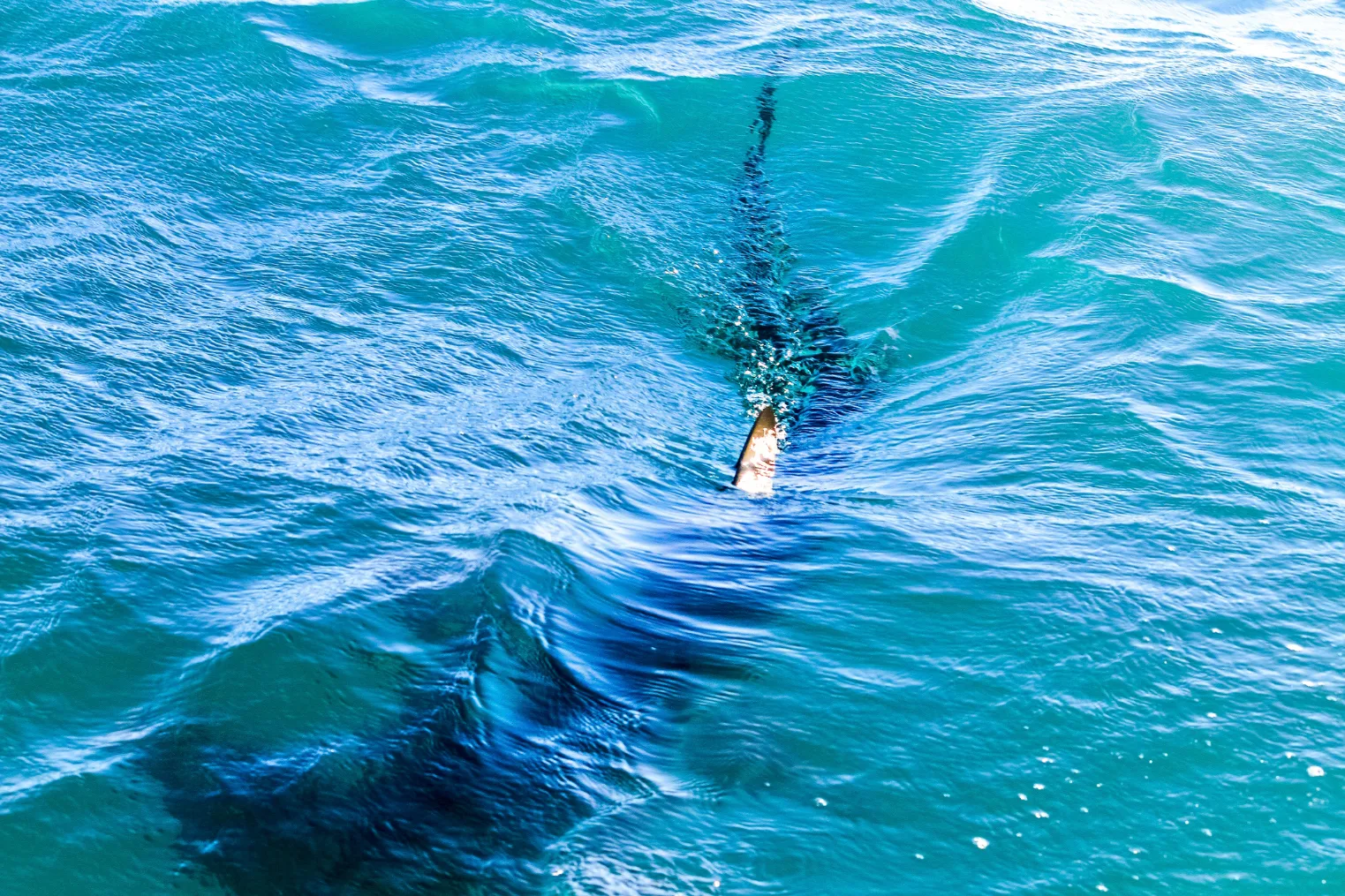
Read Swell Height for Shark-Dive Safety
Often, the safest shark dive starts by reading the swell height like you’d read the ocean’s mood, because those numbers in feet or meters translate into real surface chop, awkward ladder climbs, and a boat that suddenly feels smaller.
Many operators cancel when swell height tops about 5 ft (1.5 m), and you should too if you’re picturing slippery fins on a rolling transom.
If the forecast also flags widespread haze, keep in mind that reduced visibility can make surface coordination and boat pickup more complicated even when swell looks manageable.
- Cross-check NOAA, Surf News Network, and Windy or Windfinder, then peek at a local surf cam.
- Watch for a quick jump in swell height overnight, it can shrink your margin by launch time.
- Match swell direction to your site, head-on reef breaks mean tougher entries and exits.
- On arrival, watch sets for 10 to 30 minutes, noting where waves break.
Use Swell Period to Estimate Surge
Swell height tells you how big the ocean looks, but swell period tells you how hard it moves, and that’s what creates the push and pull you’ll feel on a ladder, at the surface, and down on the reef.
When the swell period stretches to 12–18 seconds, each wave carries extra muscle, so even a modest 4–5 ft swell can shove water across a reef.
A short 6–8 second swell might look busy, yet it usually delivers weaker, quicker surges.
Check forecasts as a pair, height plus swell period, because many operators call it off once it’s over 5 ft with a long period.
On site, time the sets, if the gaps match 12–16 seconds, plan longer surface swims or pick a sheltered cove.
For southern Oʻahu, the PacIOOS ROMS model issues a 7-day forecast updated daily around 1:30 PM HST, which can help you anticipate current-driven surge alongside swell period.
Combine Swell and Wind for Surface Chop
To judge surface chop, you’ve got to read swell and wind together, because a long-period swell that looks clean on paper can turn the entry and exit into a slapping, bucking mess once the wind gets involved.
Watch wind direction and strength like you’d watch a crosswalk signal, onshore or cross-shore winds stack waves up and make them steeper, while a light offshore breeze can smooth the surface and buy you calmer, easier surface work.
Those same conditions can also swing shark-dive visibility in Oahu, so it helps to temper expectations about what you’ll see underwater.
If the forecast shows short-period swell or mismatched wind and swell angles, pull up combined maps and buoy data, then double-check with your own eyes on arrival, since reefs and channels can crank up chop right where you least want it.
Swell Period Meets Wind
In real-world conditions, swell period and wind act like a duet, and you’ll feel it first in the slap and rattle of surface chop right where you’re trying to step in, climb out, or steady yourself for a controlled descent. This is also when seasickness prevention matters most on Oahu shark dives, because short-period wind chop can turn a manageable forecast into a rough-feeling ride fast.
Match the forecast: swell period sets the pulse, wind decides the texture. Run this checklist:
- 12–16+ seconds plus onshore wind, expect chunky sets and tricky ladders.
- 6–10 seconds, waves come fast, wind scrambles them, visibility drops.
- Light offshore wind grooms reefs and channels, smoothing entries even on long swell.
- Above 15–20 kt, chop dominates, so postpone, pick shelter, or board with perfect timing.
Cross-check Windy or Windfinder with a surf report, and you’ll spot the safer window before you commit.
Crosswinds And Wind Chop
Wind doesn’t just add a little texture on top of the forecast, it can twist a clean swell into a messy surface the moment it blows along the shoreline.
When crosswinds hit 10 to 15 knots over a 3 to 5 ft swell, the surface turns into short, sharp chop, visibility drops, and boat approaches and entries get tricky.
Check timing, too.
If wind period stays under 5 or 6 seconds and it opposes the swell, chop stacks steep and close like corduroy, boosting surge at shallow exits and hiding hands or fins.
Combine a 12 to 16 second swell with crosswinds and you’ll get rolling sets plus whitecaps, so scan Windy or Windfinder and think twice when winds top 15 to 20 knots.
Before you commit, confirm the latest sea state using wave buoy observations for your area so you’re not relying on an outdated forecast.
Check Wind Direction for Cleaner Entries
Before you even look at the swell chart, check which way the breeze’s blowing, because the right direction can turn a choppy, eye-stinging surface into a surprisingly clean, calm entry for a baited shark dive. Favor offshore or light cross-shore winds, they flatten chop; strong onshore winds above 15 to 20 knots bring spray, low vis, and sketchy launches. If you need an official baseline, the NWS Forecast Office Honolulu posts Watches, Warnings & Advisories that can flag changing marine conditions before you commit to a launch.
- Line up wind with your channel or reef so returns stay simple.
- Treat alongshore flow seriously, it can drag you down the beach.
- Use Windy, Windfinder, or NOAA nearshore maps for your dive window.
- Pick steady tradewinds over gusty shifts, and if the channel mouth starts breaking, choose another spot.
Even if the bottom looks calm, wind chop can hide fins.
Time Your Shark Dive Around Tides
When you time a shark dive to the tide, you’re really choosing what kind of water and current you’ll deal with once you drop below the surface.
Start with the tide table, then aim for an incoming flood when you can, since it often flushes clearer pelagic water inshore and sharpens visibility for those first fin silhouettes.
Be cautious with strong outgoing tides at channels or bay exits, where water can rip seaward and make holding position risky.
Check local timing too, because islands don’t always match, Haleiwa can run about an hour ahead of Honolulu, and those offsets can set up longshore flows that nudge sharks and divers off plan.
On a 2-day North Shore itinerary, aligning your dive window with North Shore highlights can help you build in flexibility if tide or conditions shift.
Keep notes on which tide phase looks clearest at your site each season.
Use Slack Tide to Minimize Current
Although the ocean never truly hits pause, slack tide gets you the closest thing to a reset button, that short window around high or low tide when the tidal push eases and your dive plan stays tidy.
Slack tide is the ocean’s near-reset: a brief high-or-low window when currents ease and your dive plan stays clean.
Try to enter within 30 to 60 minutes of predicted slack tide, using the closest tide station because harbors can differ by hour.
Because many Oahu shark dives meet and launch from specific harbors and ramps, confirm the departure point and use the nearest tide station to time slack accurately.
Even then, swell and wind can nudge you along, so pause at the surface and read the scene before you commit.
At spots known for tricky outgoing-tide exits, avoid that tide window.
- Cross-check tide tables for your exact site first.
- Arrive early, watch bubbles, foam, and floating leaves.
- Ask local operators when slack tide truly hits.
- Plan entry, dive, and exit like a loop.
Watch for Channels and Longshore Currents
Watch the channels first, because an outgoing tide often shoots seaward like a fast river, and it can pull you and the bait line off plan in minutes.
Then track the longshore current by staring at foam streaks, kelp, or a bright float for a few minutes, and note which way it slides along the beach so you can predict where everything will drift.
If you start to feel off while you’re watching the drift, focus on the horizon and keep your head still to reduce motion sickness triggers on small boats.
If nearby tide tables or a swell and wind shift don’t match what you’re seeing, trust the water in front of you, it’s the one that’ll decide your return route.
Identify Channel Outflows
On reefy coastlines, channels act like natural drains, and if you read the forecasts with a little intention you can spot the ones that’ll tug you seaward. Before a shark dive, treat channel outflow like a moving walkway you didn’t ask for, especially on an ebb when the bay wants to empty. If you’re doing a North Shore shark dive, build in extra time for parking and timing so you’re not rushing your entry during a draining ebb.
- Compare tide stations, a one hour mismatch can push water through channels toward the lower tide side.
- Check your site’s tide state, and skip strong ebb windows, Hanauma Bay style exits can feel like a river.
- Pair swell height with period, long, punchy sets breaking on reef mean more water piled in, so it must pour out.
- Watch wind forecasts and, on arrival, scan foam lines and drifting bits for speed cues.
Track Longshore Current Direction
Often the easiest way to predict where the water will slide along the coast is to treat your forecast like a map with arrows, not numbers.
Check tide times at nearby reference stations, like Haleiwa versus Honolulu, because an hour gap often means higher water on one side and a steady longshore flow toward the lower side.
Match swell direction to breaking reefs, when swell and the tide difference push the same way, the current builds fast and can carry you down-coast.
Factor wind: calm or southerly days may let tide-driven flow dominate or reverse your usual line.
Scan charts for channels or reef gaps, then on arrival read kelp, foam streaks, and swimmers pointing into the push; an incoming tide often softens exits.
If you’re heading from Waikiki to the North Shore for a dive, build extra buffer for Waikiki-to-Oahu travel because arrival timing can change which tide phase and longshore push you actually enter.
Predict Shark-Dive Visibility From Swell + Tide
Visibility is the quiet currency of a great shark dive, and you can estimate it pretty well by reading swell and tide together before you ever zip your wetsuit.
Visibility is the quiet currency of a great shark dive, read swell and tide together before you ever zip your wetsuit.
Swell height and period set the tone: 6 ft at 7 seconds churns sand, but 3 ft at 13 seconds can leave water clearer and improve dive conditions.
Tide fine-tunes it, too.
- Aim for slack to incoming tide, it often brings in bluer water.
- Be wary of strong outgoing flow, it carries haze and grit.
- Check nearby tide stations, a one hour offset can create cross-currents.
- Scan reef or shelf breakers, nonstop whitewater means silt is lifting.
Oahu’s water temperature by month also helps you plan a wetsuit that keeps you warm enough to stay still and patient when visibility is at its best.
Take a look from the boat; if the water looks milky, expect it below.
Plan Shark-Dive Entry, Exit, and Backups
Clear water is a nice bonus, but your win is a clean, unhurried way in and out, so plan your diving entry, exit, and a backup before you even clip on your fins.
If swell tops 5 ft, or the period runs long and punchy, skip it, those waves turn a surface swim into a washing machine.
Cross check wind on NOAA and Windy or Windfinder, because onshore or strong southerlies stack chop and shove water into channels, shrinking your exit window.
Use tide charts, and confirm local timing, since nearby islands can be an hour off, then aim for the phase that suits the site, often an incoming tide.
Pick an alternate site, set an abort trigger, and keep reserve air for surprises.
Do the Final On-Site Ocean Check
Before you unzip the suit and stride in, give the ocean a proper 10 to 20 minutes of your attention, because quick looks can flatter you with a calm set and then slap you with the next one. Walk the shoreline, and pay attention to swell size, wave period, and how sets break over the reef or into the channel.
- Note tide stage and flow at entry and exit, an outgoing tide can block your return.
- Look from beach, channel, and reef points, heavy surf on one side hints at strong pull.
- Follow foam lines, kelp, and drifting bits, and watch how fish hold in place.
- If it feels wrong, delay or move sites, confirm guides, rescue plan, and keep extra air for safety.
Frequently Asked Questions
What Certifications or Minimum Experience Should Divers Have for Shark Dives?
You’ll usually need Advanced Open Water or equivalent; these Certification prerequisites reflect 60–100+ ft profiles. Bring 20–50 logged dives, current/drift experience, and solid buoyancy, mask clearing, and controlled ascent skills for baited, crowded encounters too.
Do Sharks Behave Differently During Mating, Pupping, or Feeding Seasons?
Yes, Seasonal behavior shifts. You’ll see sharks aggregate to mate or pup in sheltered shallows, raising encounter odds. During prey runs, they feed harder and compete. You should time dives carefully, especially near nurseries too.
Are Chum, Bait Boxes, or Attractants Legal and Ethical at This Location?
You can’t assume chum or bait boxes are legal or ethical here; Local regulations decide. Like a lantern in fog, you’ll verify MPA and fisheries rules, permits, and operator policies, and avoid conditioning risks.
What Emergency and Evacuation Plan Should the Boat or Shore Team Have?
You’ll keep a written Emergency Procedures plan: assign roles, comms flow, hospitals/ETAs, and GPS evac sites. You’ll carry VHF/DSC, sat phone/EPIRB, trauma kit, O2, AED, lights; drill quarterly and prearrange medevac for rapid shore transfer.
How Should Divers Manage Cameras and Lights to Avoid Stressing Sharks?
Use Gentle handling: move your camera slowly, keep strobes tucked close, and don’t thrust gear forward. Choose neutral, non-reflective housings, dim or angle lights down, maintain posture, keep eye contact, and stop if sharks agitate.
Conclusion
You’re ready to call it, and coincidence helps, the buoy ticked up overnight, the wind clocked onshore at breakfast, and the harbor flags now snap like wet laundry on a line. Use your checklist, match swell direction to your site’s shelter, and time your dive for slack or the first push of incoming tide so visibility stays clean. Watch the water for 10 minutes, ask the operator twice, and if it feels wrong, don’t go.