On Oʻahu, a single tiger shark can show up in dozens of photo-ID shots over years, like a regular with a recognizable jacket. You can track who’s studying them by looking for the quiet teamwork, HIMB and the Holland Lab crunch tag data, NOAA cross-checks bycatch reports, and One Ocean logs clean dive notes, while locals and visitors feed sightings into Hawaii Shark Counter. Pack patience, snap clear side photos, note time and place, and you’ll see what’s missing next.
Key Takeaways
- Researchers on Oʻahu include university labs, state/federal biologists, and nonprofit teams studying sharks through in-water surveys and offshore expeditions.
- Satellite and acoustic tags track migrations, depth, temperature, and nearshore residence using receiver arrays that log when tagged sharks pass by.
- Deep-water and telemetric video cameras record behavior down to about 500 feet, pairing footage with depth, temperature, time, and season.
- Photo-ID catalogs (300+ individuals) match fin nicks and scars, documenting seasonal returns, growth, and site fidelity with fewer repeat captures.
- Green-laser photogrammetry and citizen tools (Hawaii Shark Counter, Sharktagger) add low-impact size and sighting data with time-stamped locations.
What Oʻahu Shark Research Is Finding Now
Often, the most useful shark research on Oʻahu starts with simple tools that work quietly in the background, satellite tags, acoustic pings, and a steady stream of photos that let scientists follow individual sharks like familiar regulars.
When you track signals daily, you see routines, commuting depths, and long-haul migrations, plus temperature and depth profiles that match shifting ocean conditions. Photo-ID catalogs, now 300-plus faces, help you measure how often sharks return, how visits change with seasons, and how habits shift as they grow.
Add cameras and receiver arrays, and you map life from blue to 500 feet down. Telemetry and video flag swim patterns and displays that raise longline risk, so you can test bycatch fixes with fishers and citizen reports up close.
Researchers also cross-check movement patterns against ocean conditions using tools like PacIOOS Voyager that combine observations, forecasts, and historical ocean data.
Which Sharks Are Studied Around Oʻahu: and Where?
Around Oʻahu, you’ll most often hear researchers talk about sandbar and Galapagos sharks, because they show up reliably at a handful of nearshore aggregation spots where clear water and repeat visits make photo-ID tracking practical.
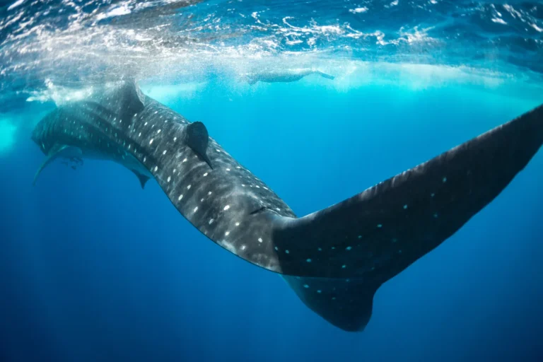
Head offshore and the cast shifts to oceanic whitetip, silky, and bigeye thresher sharks, and you’ll see why tagging teams work from boats in open blue water where these travelers cruise and where a satellite ping tells a better story than a shoreline map.
If you’re hoping to compare research targets with what visitors commonly encounter, guides to sharks around Oahu highlight many of the same nearshore species that show up in these study areas.
As you map the island in your head, think in zones, reefy gathering areas close in, deeper camera and receiver lines farther out, and pelagic waters beyond, and if you’re watching from land, check public sighting tools like Hawaii Shark Counter for real-time clues on where activity’s clustering.
Common Study Species
Where do researchers look when they want to understand Oʻahu’s sharks, the ones cruising close to shore and the ones slipping through deep blue water? You’ll see two main casts, reef regulars and open ocean roamers, and you can match each to a tool kit, starting with careful Shark ID from photos and video. Sandbar sharks, in particular, tend to show up in predictable habits and hotspots around Oʻahu, which helps researchers plan repeat surveys.
| Species | Main approach |
|---|---|
| Sandbar, Galapagos | photo-ID catalogs, season checks |
| Tiger, hammerhead | cameras, behavior notes, sizing |
| Oceanic whitetip, silky | satellite tags, migration maps |
| Bigeye thresher | archival tags, depth and temp |
When you watch the data roll in, you learn who comes back, who vanishes offshore, and how fishing pressure shapes survival. Treat nearshore sharks like neighborhood surfers, note fins, scars, and shading, then log repeats, month to month, in your notebook.
Key Oʻahu Study Sites
Just off Oʻahu’s beaches and out past the drop-off, shark research happens in a handful of reliable “check-in” spots, places scientists return to because the same animals tend to show up on cue. Follow the island’s circuit and you’ll see how each site fits a Research Program, from bays to blue-water moorings.
- Nearshore aggregation areas: divers shoot noninvasive photo-ID of sandbar and Galápagos sharks, building a catalog of 300 plus familiar fins.
- Inshore bays like Kāneʻohe and Heʻeia: video, photogrammetry, and weather data track seasonal shifts and where young sharks hang out.
- Leeward offshore and Kona-style deep water: satellite tags, acoustic receivers on FADs, and occasional 500-foot cameras log migrations, depth, and temperature for hammerheads, tigers, whitetips, silkies, and threshers.
Galápagos sharks are often identified in Oʻahu waters by their broad, rounded snout and tall dorsal fin, and researchers watch for cruising behavior along deeper drop-offs and ledges.
Oʻahu Shark Research Teams and Partners
Oʻahu’s shark-science network is a tight, island-hopping mix of lab teams, conservation groups, and everyday ocean users, and once you know who’s doing what, the research starts to feel as easy to follow as a reef map.
Oʻahu’s shark-science network links labs, conservationists, and ocean users, once you know the players, the research reads like a reef map.
At HIMB and affiliated labs like the Holland Lab, you’ll see sharks fitted with satellite and acoustic tags that log depth, temperature, and routes for oceanic whitetip, silky, and bigeye thresher.
With One Ocean Research, you use photo ID and photogrammetry to match sandbar and Galapagos sharks to a catalog of 300 plus individuals.
Ocean Ramsey’s partners add video, including deep water cameras to about 500 feet, to read displays, site fidelity, and encounters.
NOAA and local fishermen team up to test bycatch fixes, and personal deterrents.
If you’re planning to observe sharks at sea, August tends to bring busiest crowds to Oʻahu shark-diving charters, so booking early can make field days easier to coordinate.
Citizen Scientists Powering Oʻahu Shark Research
You can step into Oʻahu shark research through community tagging workshops, where you’ll help rig and record tags and learn what to pack, think gloves, a snug hat, and patience in the salty wind.
You’ll also see how fishermen and onboard observers team up with researchers to log bycatch and post-release outcomes, turning real-world deck notes into safer longline practices.
Clear guidelines distinguish feeding from scent trails and chumming so research and safety efforts don’t accidentally condition shark behavior.
And when you report sightings with a time stamp, a clear location, and a sharp photo through tools like Sharktagger or social IDs, you’re adding puzzle pieces that help track sharks across beaches and seasons without ever putting a hand on them.
Community Tagging Workshops
Joining a community tagging workshop feels like stepping onto a working research boat, salt on your lips and clipboards in hand, where local fishermen and volunteers help tag pelagic sharks like oceanic whitetips, silkies, and bigeye threshers.
You’ll practice safe, noninvasive tagging and note water temperature and depth, so Pacific Islands Marine Biology teams can study shark travel in environmental conditions.
These community tagging workshops grow a data set for Research and Conservation, testing bycatch tweaks for fisheries science and a satellite tag’s depth profile for site fidelity and population dynamics that occur throughout Oʻahu.
Data from these trips can support ecosystem-based management by building the scientific foundation for conservation strategies in Pacific Island waters.
- Keep the Shark wet, supported, and release fast.
- Log human impacts, hooks, traffic, depredation.
- Send sightings to [email protected] or the Sharktagger page for collaborative research projects.
Fishermen-Observer Collaboration
Step aboard the research side of the docks and you’ll see how fishermen, fisheries observers, and local scientists team up to turn an ordinary longline set into solid shark data, with wet decks, pencil marks on waterproof forms, and quick checks of hooks and injuries before release.
You’ll watch Islands observers log each capture and release, and you’ll help Research gauge post release survival by timing the fight and scoring hook wounds.
If the shark’s strong, you’ll back a tagging team as they attach satellite or acoustic tags to oceanic whitetip, silky, or bigeye thresher sharks, then download depth and temperature tracks.
Crews also test bycatch deterrents in conditions, so bring deck boots, keep fingers off the leader, and let the forms dry flat.
To strengthen this work, the team leans on Hawaiʻi Sea Grant’s integrated research, extension, and education activities focused on coastal and marine resources.
Sightings And Citizen Reporting
Back on shore, the work doesn’t stop when the last longline buoy slips out of sight, it spreads to beaches, boat ramps, and phone screens where everyday sightings turn into usable shark records. When you spot a fin in the blue, you can post to the Hawaii Shark Counter or Sharktagger, or email [email protected], adding photos, time, and location for Community Reporting. If you’re coming from a shark dive tour, stash phones, wallets, and keys in a dry bag or leave them on shore to protect your valuables.
- Snap shots of scars and markings, they help match a photo ID catalog of 300 sharks, so researchers tag fewer animals.
- Note temp, moon phase, swell, and shoot video each dive, it links sightings to seasons.
- Join tagging workshops or scientific charters, you’ll assist with data and behavior notes that pair with telemetry to flag bycatch and depredation hotspots
Photo-ID in Oʻahu Shark Research (Low Impact)
Spotting a familiar shark by its own “freckles,” scars, or a nicked fin has become one of Oʻahu’s smartest low impact research tricks, and you can picture it like birding underwater with a camera instead of a net.
With sharp left and right profile photos, Ocean Research and One Ocean Sharks match Scarring Patterns and deformities to a 300 plus shark catalog, showing site fidelity without tags.
Use green laser dots to estimate length, and you’ll capture growth, seasonal counts, and shifting hangouts.
Because this relies on calm, controlled positioning and clear visibility, it pairs naturally with cage-free shark diving practices that keep encounters low stress and observation-focused.
Upload your best shots to Hawaii Shark Counter, and the time and place data improves matches.
Over months, paired images, dive video, and notes on temperature, swell, and moon phase map behavior and visitation for sandbar, Galapagos, tiger, and scalloped hammerheads.
Deep-Water Cameras Used in Oʻahu Shark Research
Out beyond the reef line, where the light fades to a cool blue and bubbles sound louder than you’d expect, deep-water cameras let researchers watch Oʻahu’s sharks on their own schedule, down to about 500 feet, without ever needing to tag them. You drop the rig, hit record, and later you can rewind sandbar and Galapagos patrols, tiger cruisers, and scalloped hammerheads slipping through Vertical schooling bait. Visibility can swing from murky to clear depending on typical visibility ranges and conditions like swell, wind, rain runoff, and plankton blooms.
- Pair video with depth, temperature, time, and season so you can spot diel and seasonal shifts.
- Freeze frames to log species mix, schooling dynamics, and tense face-offs.
- Use sharp stills for photo-ID and photogrammetry, comparing scars like passport stamps.
Tip: keep notes on current and visibility, because the clearest minutes tell the best story.
Telemetry Arrays Tracking Oʻahu Sharks
Along Oʻahu’s moorings, where a FAD chain creaks with the swell and the water turns from turquoise to ink, receivers sit quietly and “listen” for the pings of acoustic tags, letting researchers map which sharks show up, how long they stay, and when they hop between coastal hot spots.
Think of the island as check-in points, each receiver logging time stamps as a tagged shark cruises past. Add satellite tags on oceanic whitetip, silky, and bigeye thresher sharks, and you’ll track depth, temperature, and routes far offshore.
Mix in newer sensors, and you can spot ocean conditions that raise capture risk in tuna longlines, using data from releases with fishers and observers. Acoustic ethics counts, so arrays and photo-ID reduce repeat tagging over time.
These tracking insights help support shark conservation efforts in Hawaiʻi by clarifying where sharks spend time and when they’re most vulnerable.
When Shark Tagging on Oʻahu Is Worth It
You tag sharks off Oʻahu when you’ve got a high-value question and you can keep the work low-impact, like using satellite tags on oceanic whitetips, silkies, or bigeye threshers to log depth and temperature and map where they roam, rest, and switch gears from day to night. You also build public trust when you’re transparent about attractants and avoid practices associated with baited shark tours. You’ll also get real traction when you pair tags with observer notes from tuna longline trips to estimate post-release mortality, or when you add acoustic receivers on FAD mooring chains and local arrays to catch fine-scale loops around the island, like tracking footprints in wet sand. You skip tagging when photo-ID can answer it, but you lean in when pelagic travelers blur the picture or when you’re testing bycatch fixes, and you’ll move faster if you team up with local fishers, community workshops, and observer programs so your data lands in management, not just in a spreadsheet.
High-Value Research Questions
While the water off Oʻahu can look calm and postcard-blue, shark tagging only earns its keep when it answers a few high-stakes questions that photo snaps and casual sightings can’t, especially for species that show up in bycatch or carry conservation worry like oceanic whitetip, silky, and bigeye thresher sharks. You want Ecosystem connectivity mapped, plus survival data you can defend. Oxygen and chlorophyll sensors sharpen that story, too. Hammerhead presence around Hawaiʻi also shifts with seasonal sightings, which tagging can verify beyond anecdotal reports.
- Do released sharks live, and which handling or sea conditions raise mortality?
- Where do they go daily and seasonally, using depth and temperature records?
- Which bycatch fixes, like gear changes or faster releases, reduce recapture risk?
Combine satellite or archival tags with observer logs or FAD receivers to guide local fishery management.
Low-Impact Tagging Conditions
On calm, glassy mornings off Oʻahu, shark tagging is worth the effort only when it stays light on the animal and heavy on the answers, especially for species that take hard hits in bycatch like oceanic whitetip, silky, and bigeye thresher sharks.
You’ll work with crews on fishing operations or scientific charters, using quick deploy satellite or archival tags that log depth and temperature while you keep air exposure short and hands steady.
Aim for minimal restraint, place the tag away from essential muscle, and get the shark moving again fast, like a pit stop.
Choosing a boat that follows a clear operator checklist helps ensure the team is set up for low-stress handling and responsible fieldwork.
You’ll lean on ethical permitting, fisheries observers, and photo ID catalogs so you don’t tag the same regular twice, then test methods locally on FAD arrays before scaling up.
What Oʻahu Shark Research Shows About Site Fidelity
Often, the biggest surprise in Oʻahu shark research is how familiar the same fins can look from season to season, like spotting a regular at your go-to beach park.
When you join photo-ID surveys, you learn Site loyalty isn’t a slogan, it’s measurable, with 300 plus individuals logged by scars and markings, and their return dates lining up with temperature, swell, and moonlight.
You can also track growth with green-laser photogrammetry, then notice some sharks shift hangouts as they age, yet still circle back to key aggregation spots.
In Hawaii, knowing the difference between white-tip and black-tip reef sharks helps researchers interpret who’s showing up at these nearshore sites and when.
- Sandbar and Galapagos sharks often show high, seasonal residency.
- Tiger and scalloped hammerheads pop in, then range wider.
- Telemetry confirms semi-residents, cruising nearshore for weeks, then taking occasional long trips. Take notes ashore.
Do Magnets or Metals Change Shark Behavior on Oʻahu?
Curiosity drives a lot of Oʻahu shark research, especially when you’re staring at a shiny clip, a hunk of metal, or a magnet and wondering if a shark will treat it like a “keep out” sign or just another piece of ocean clutter.
At HIMB, the Holland Lab, and One Ocean partners, you test magnetized tags and metal pieces near baited or natural spots, then score approach distance, feeding strikes, and schooling in tiger, scalloped hammerhead, and Galapagos sharks.
Species variability is the headline: some trials cut approaches or bites, others barely budge behavior.
Context matters, so you log temperature, depth, and time, and match video with acoustic or satellite tracks.
If you fish, join local workshops to trial deterrents before wider real use.
These projects also tie into ocean stewardship by sharing practical ways divers and fishers can reduce impacts and give back to the sea.
How Oʻahu Shark Research Avoids Stressing Sharks
Usually, the best shark research on Oʻahu looks less like a wrestling match and more like a quiet checklist, you watch, record, and move on. You use photo-ID catalogs of 300-plus sharks, reading scars and fin notches to spot regulars without handling them. If tagging’s needed, trained staff work fast with external satellite or acoustic tags, plus bycatch tweaks that shorten capture and blunt Stress Indicators. You also coordinate with responsible operators so research dives don’t incentivize baiting or crowding that could alter shark behavior.
- Record video on each dive to log normal and agonistic moves.
- Set remote cameras down to 500 feet, so data comes to you.
- Size sharks with green-laser photogrammetry, not a tape measure.
You also mount acoustic receivers on fish-aggregating devices for passive detections. You invite time-and-place photos via Hawaii Shark Counter and Ocean Shark ID.
Human–Shark Interactions Studied Around Oʻahu
While you’re watching the surf lines roll in off Oʻahu, shark researchers are watching something just as changeable, how people and sharks share the same water without stepping on each other’s toes.
They match long-term photo-ID catalogs of 300+ sharks to see who hangs around, when they return, and which seasons bring crowds. Telemetry and satellite tags on pelagic travelers log depth and temperature, then flag conditions that raise fishery risk. Dive video and shore surveys note swim routes and warning postures, so tour boats and fishers can tweak habits. Add moon phase, swell, and water temp to encounter records, and you’ll see patterns that shape Risk perception, like why a clear, calm day can feel “safer” yet still draws sharks close to reefs. On cage dives, researchers also note that shark approaches can vary widely, helping set realistic expectations about how close sharks get.
How to Join Oʻahu Shark Research (Data, Photos, Trips)
Jump in the way locals do, with a camera, a logbook, and a little patience, and you can support Oʻahu shark research without needing a lab coat or a giant boat.
Grab a camera and logbook, add patience, and help Oʻahu shark research, no lab coat or big boat required.
Start with Beach Photography from shore nearby, snap profile shots, note time and GPS, then share them with the Hawaii Shark Counter/ID team so scars and photogrammetry can match 300 plus individuals. On many Oʻahu shark dives, researchers also log green sea turtles, dolphins, and rays as part of broader marine-life sightings.
- Book a One Ocean Research charter with Ocean Ramsey’s Shark ID crew, you’ll gather dive video, behavior notes, and measurements for long-term studies.
- Join public tagging workshops, you’ll learn careful handling as satellite or acoustic tags go on oceanic whitetip, silky, bigeye thresher, sandbar, or Galapagos sharks.
- Send sightings to [email protected] or Sharktagger, your report supports receiver checks at fish-aggregating devices.
Frequently Asked Questions
How Is Shark Research on OʻAhu Funded, and Who Pays for Equipment?
You fund Oʻahu shark research through mixed Funding Sources: Hawaiʻi state salaries and labs, federal NOAA/NSF grants, and project contracts. You pay for tags and cameras via grants, partnerships, in-kind maker support, and community donations.
What Permits or Approvals Are Required to Study Sharks in Hawaiian Waters?
You’ll meet Permit requirements by securing DLNR-DAR scientific collecting/endangered species permits for state waters, NOAA/Monument permits for federal areas, ESA/MMPA authorizations when needed, IACUC approval for invasive handling, and local community MOUs before fieldwork begins.
How Are Shark Research Data Stored, Shared, and Protected for Privacy?
You store shark data in databases and citizen-science platforms; share telemetry and photo-ID under agreements or embargoes. You practice Data stewardship by redacting sensitive locations and identities, generalizing releases, and routing access requests through contacts.
How Do Researchers Handle Conflicting Sightings or Misidentifications in Reports?
Trust, but verify: you’ll handle conflicts through Sightings verification, cross-check photo-ID scars, use laser photogrammetry plus time-place metadata, review dive video for diagnostic traits, confirm with tag detections, and let expert-curated databases interview observers before logging.
How Can Schools or Educators Access Shark Research Materials for Students?
You’ll access shark research materials by emailing university lab outreach coordinators for datasets, guest talks, and fieldtrips; building Curriculum partnerships with Heʻeia Reserve or MakerLab; submitting student photos to ID databases; requesting telemetry data directly.
Conclusion
You’re walking Oʻahu’s reef like a lantern bearer in an old canoe tale, you don’t chase the shadows, you learn their routes. Today’s shark research works the same way: photo IDs, tags, deep cameras, and fisher logs sketch a living map with minimal fuss. If you spot a dorsal fin in glassy water, note the time, place, and swell, then share it. Pack reef safe sunscreen, keep your distance, and stay curious.